Frequently asked questions about Expansion Tectonics
Question: [Click here to toggle answer on/off]
Scientists tell us that they can now measure the radius of the Earth using satellites to sub-millimetre accuracy and from this they conclude that the Earth is not expanding. How does this fit in with Expansion Tectonics?
Answer:
The answer to this question is quite simple. It is worth quoting from Shen and others 2011 paper where they gave a brief overview of how raw satellite observational data is treated before using it to calculate a variation in Earth radius. In their paper they used space geodetic data collected and published in 2008. In this data they say that “...there are 1572 readings at present from various stations...Due to discontinuities of many recordings, only 930 recordings...are available for present study.” Also, “...stations that are very close to each other...are merged to one station...Then, there are 841 stations left...in this study the stations located in active tectonic zones...have been removed from our calculations.” Furthermore, “Another concern is that the absolute values of the vertical velocities of some stations are beyond 0.02m/year, and so large vertical movements of such kinds of stations are not related to Earth expansion...Hence, such kinds of stations are not included in our calculations...After removing the stations located in the orogenic zones and the stations whose vertical velocities are greater than 0.02m/yr, there are 625 stations left...Our calculations show that the Earth is expanding at present at an expanding rate of 0.24±0.04mm/yr.”
From this overview it can be seen that 60 percent of the raw observational data were eliminated before calculating a rate of change in Earth radius simply because this data didn’t fit the geodesists’ pre-conceived static radius Plate Tectonic model of the Earth. In other words, what they did was remove all data that might otherwise indicate Earth expansion. This, in effect, smoothed out the raw data before making their calculation. By doing this Shen and others then concluded “...the Earth is expanding at present at an expanding rate of 0.24±0.04mm/yr.” This smoothed and calculated data is now routinely published on the Internet for all to see and use.
To eliminate 60 percent of the measurements before calculating Earth radius, especially when the vertical motions are so small, is misleading and erroneous and also forces the observational data into a preconceived static radius Earth model. From an Expansion Tectonic perspective, all space geodetic measurements must be considered relevant and must be used during calculation. In addition to this observation, the choice, location, and amount of observational stations distributed around the world also potentially bias the outcome of this space geodetic calculation. By “… removing the stations located in the orogenic zones and the stations whose vertical velocities are greater than 0.02m/yr” this will definitely bias the outcome of the radius calculation by removing the very measurements that should show an increase in Earth radius. Many more observational stations than currently available around the world would definitely be needed before this bias could be minimised and a meaningful increase in Earth radius be calculated from space geodetic data.
If the radius of the Earth 200 million years ago was 50% of what it is now then surely the Earth would have been completely covered in water?
Answer:
This is an important point to note because many researchers still insist that the total volume of ocean water has remained constant throughout time, or has been periodically added to during meteor impacts or from passing comets. In the past, this inferred constant volume has also been used as a strong objection by others to refute Earth expansion. It was implicated by these researchers that on an assembled Pangaean Expansion Tectonic Earth model the entire lands would have been covered by over six kilometres of water, which, as shown by my modelling studies, is not consistent with the geological evidence.
On an Expansion Tectonic Earth, small Earth modelling evidence shows the volume of ocean water has been increasing steadily since Archaean times and most prominently since the post-Permian opening of the modern oceans—some 250 million years ago. The post-Permian increase in volume of new water has occurred in conjunction with intrusion of a huge volume of entirely new volcanic seafloor crust along the global network of mid-ocean-ridge spreading zones. This new water, plus accompanying atmospheric gases, represents the escaped volatile elements which occur naturally within the crystal lattices of all molten volcanic rocks.
Petrological studies—the study and observations of rocks under the microscope—show that up to fifteen to twenty percent of the weight of a new volcanic rock may comprise fluid and gaseous elements. Graphic evidence of the release of these volatile elements can be seen from both volcanic eruptions on land and from black smokers pouring out huge volumes of new superheated water and gases from deep within the mid-ocean-ridges. Once the volcanic rocks are intruded as lava near the Earth’s surface, these volatile elements are then expelled, or boiled off, during formation of new surface lava or seafloor volcanic crust.
When I do a search on the expanding Earth the responses that I always get tell me that this theory is now defunct and has been rejected by mainstream science. How does this fit in with Expansion Tectonics?
Answer:
This is a valid observation, one that frustrates all that are doing genuine research into Expansion Tectonics. The primary objective of science is to discover and investigate the true characteristics of nature. Scientific scrutiny follows on from discovery and involves methodical and careful examination of all evidence, both observational and experimental.
Ideally, in gathering and investigating this evidence a true scientist should remain open minded and unbiased. Theirs is not to predict an outcome but rather to determine an acceptable and logical manner in which nature operates. Unfortunately today, as in many scientific disciplines, those proclaiming to be involved in true science act as individuals. Often researchers have neither done extensive research in the discipline (primarily because they have not been trained in the discipline) or have accumulated the required practical or academic experience by being involved in the discipline for an extended length of time. This is not just true of geology but similar statements are applicable to many other scientific fields of endeavour.
For example, numerous attempts have been made to establish a Wikipedia page devoted to the subject of the expanding Earth = Expansion Tectonics (see: http://en.wikipedia.org/wiki/Expanding_Earth and comments at: http://www.dinox.org/wikiwars.html) and this page has been consistently attacked and distorted, in a similar manner to those defacing walls and other surfaces by graffiti. And to add to this mischievous behaviour this vandalism is carried out by those possessing little knowledge of the discipline and even less knowledge of the subject being presented. So, to answer your question, don’t believe all that you see on the Internet. The theory of Expansion Tectonics is alive and well, we just have to somehow get around the Wikipedia vandals so as the true message can be posted for all to see for themselves.
Geophysicists have been using palaeomagnetic data to locate the position of the ancient supercontinents for many years now. This data is considered to more than adequately substantiate plate tectonics and is well founded. So, are you now saying that this is all wrong?
Answer:
For too long now geophysicists have been driving plate tectonic studies and the other disciplines, such as geology, geography, and biogeography, have had to fit in as best they can. This is not how the Earth works. All of the Earth sciences must be considered when it comes to tectonic studies.
In contrast to plate tectonics, palaeomagnetics on an Expansion Tectonic Earth plays only a minor role. This role is to locate the ancient poles and equator, nothing more nothing less. Expansion Tectonics is, in fact, an opportunity for geologists and geographers to take control and drive tectonic studies in a way that the physical evidence preserved on Earth is telling us. In Expansion Tectonics it is Earths physical data that dictates the tectonic theory, not the other way round where plate theory dictates how the data is interpreted.
Why is it so important to consider ancient poles and the equator in tectonics?
Answer:
Information about the Earth’s ancient magnetic field is preserved in most rocks in the form of weak remnant magnetism. The direction of this remnant magnetism can be measured using sensitive instruments and from this information the ancient colatitude (the angular distance from the sample site to the ancient pole) and declination (an angle to the ancient pole relative to the present-day pole) can be used to locate the position of the ancient pole. This science is called palaeomagnetics.
Ancient poles on conventional plate tectonic assemblages do not cluster together globally. Instead, they are used to determine an apparent-polar-wander path. This, in turn, is used to constrain the position of the ancient supercontinental crusts during modelling studies. Because of the limitations of palaeomagnetics on a plate tectonic Earth there are a multitude of plate-fit options available for the position of each of the supercontinents.
In contrast, on an Expansion Tectonic Earth all ancient pole measurements cluster to form diametrically opposed north and south poles, as they should do. From this, the ancient equator can then be readily determined by measuring through 90 degrees of latitude from each pole.
Expansion Tectonic reconstructions do no rely on palaeomagnetics to constrain supercontinental assemblages. It relies solely on the geological evidence preserved in the crusts and hence there is only one plate-fit option available for each of the supercontinents. Locating the ancient poles and equator on an Expansion tectonic Earth is simply used to establish a geographical latitude-longitude grid to then study the distribution of ancient climates and geography in relation to plant and animal species habitats.
In your explanation for increase in Earth mass, do the solar particles from the Sun accumulate at the poles, or do they accumulate elsewhere in the Earth?
Answer:
It is proposed that incoming charged solar particles, in the form of electrons, and protons, enter the Earth at the poles and travel and recombine together to form new matter within the D” region, located at the core-mantle interface. This process is vaguely similar to electrons travelling along power lines from a distant power generation station to, say your kitchen appliance at your home.
While it is acknowledged that this proposal is new science and remains somewhat speculative, measurements and observations from dedicated satellites orbiting the Earth confirm that entry of these charged particles is more prolific than previously thought. From this, we are committed to ask, what happens to these charged particles once they enter the Earth, as well as asking what happens to the Earth once they enter. Charged particles in must equal an increase in Earth mass – regardless of the prevailing tectonic philosophy.
When I read your work, it seems very convincing, and I wonder why this is so absolutely impossible to consider to the scientific community. Have you not thought of having your globes transferred to map format for easier inspection? I would really love to see your models in a high quality HD-animation. Something to think about.
Answer:
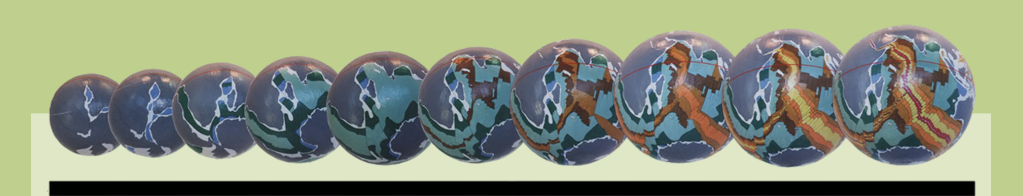
The globes shown in my website and publications were made using 300mm diameter polystyrene spheres. The geological mapping, as shown on the published Geological Map of the World, was first reformatted from the standard Mercator projection format into a 24-gore sinusoidal format. This then enabled the various plates to be cut from the sinusoidal map and assembled and pasted directly onto the foam spheres without projection distortion. All this was done at a time (late 1990s) when 3D technology and animated modelling was at its infancy.
Ideally you are correct, this work needs to be presented in a more accessible format for all to inspect and use. My own thoughts are that it should be made available in a Google Earth-like format so as people can interact with the models directly on screen – there is far too much projection distortion in a flat map to be meaningful. I have included a few Google Earth models in my website as examples of this technology, but they only go back in time to around 100 million years or so. The remaining globes, extending to 4,000 million years ago, require a lot of work to get them into a suitable format.
If there are persons out there that can do this it would be a tremendous boost to understanding and appreciating what Expansion Tectonics has to offer.
I am convinced that the expanding earth theory is correct, but you find the mechanism elusive. You talk about the mass increasing. There are apparently geological structures called “tidalites” and there are some that would indicate that millions of years ago, earth’s day was only 18 hours. Now if the smaller earth had a day of 18 hours, and it expanded to present size, WITHOUT an increase in mass it would need to decrease its speed of rotation to conserve angular momentum-hence a 24 hour day.
Answer:
Thank you for your informative question. Contrary to what you say, Expansion Tectonics has now come up with a plausible mechanism for the required increase in Earth mass over time. This is briefly outlined in my website and in detail in my new book called: “On the Origin of Continents and Oceans: A Paradigm Shift in Understanding” – available through Amazon.com.
The mechanism involves the influx of charged ionic particles (electrons and protons) emanating from the sun and entering the Earth. These charged particles gravitate to the core-mantle boundary layer where the recombine to form new matter – which is the building blocks of all elements and mineral species on Earth. This increase in new matter causes the mantle to swell, which is manifested at surface as crustal extension.
This charged particle mechanism is being monitored by dedicated space craft which are mapping the Earths inner space environment and have found, contrary to what was previously assumed, that these particles readily enter the Earth’s atmosphere and penetrate into the Earth itself. If we have an influx of charged particles then this must mean that the Earth’s mass is increasing, regardless of which tectonic theory is currently in vogue.
Regarding the tidalites, which are more collectively termed “rhythmites” and include fine banding seen in many seashells, it is important to realise that this rhythmic banding records cycles – daily, lunar and yearly, which are not the same as today. In order to use this information to determine the length of these ancient cycles researchers in the past have mistakenly assumed a constant yearly cycle, hence record variations in the length of the daily and lunar cycles. I have looked into this on a number of occasions and it is impossible to determine the length of all 3 cycles without assuming some constancy somewhere along the line. Hence why this field of research, and its relevance to angular momentum, was abandoned a long time ago.
I'm in the midst of reading the digital version of your great book. The beauty and significance of the expanding Earth models, and the consilience of multiple geophysical, geological, and paleontological data sets--only on the expanding Earth--is exhilarating to contemplate. It is no exaggeration to compare the historical significance of your book with Nicholas Copernicus' "De Revolutionibus Orbium Coelestium". The understanding of the expanding Earth changes everything in cosmology, astrophysics, planetary physics, the evolution of solar systems, nuclear physics, and the relation of mysterious source of the magnetic fields of planets and stars to the source of the new atomic matter that presents itself in the core of all "heavenly spheres." Truly breathtaking!
Answer:
Wow, many thanks for the wonderful accolades.
Why are pillow basalts (presumably formed in mid-oceanic spreading zones/ridges) found far inside continental margins, like in the Eastern Goldfields of Western Australia. To me, this shows very clearly that the "break up of super-continent >> spread of continents >> re-formation of super-continent", is an on-going cyclical process??
Answer:
My website and new book explains the formation of the ancient supercontinents, plus the modern continents and oceans in detail. In contrast to plate tectonics, on an Expansion Tectonic Earth the pillow basalts that you refer to were formed within spreading ancient continental seas—the pre-cursors to modern mid-ocean-spreading zones. At that time there were no modern oceans and all of the modern continents were assembled together to completely encompass the entire Earth on a smaller radius Earth - see spherical models and animations on my website.
The Eastern Goldfields pillow basalts—called “greenstones”—that you refer to are late-Archaean to very early Proterozoic in age and represent a time when the ancient crusts were just starting to fragment. These basalts are of a similar age and character to the ancient pillow basalts found world-wide, such as in the ancient cratons in Africa, Scandinavia, Canada, Antarctica, and so on. On my Archaean Expansion Tectonic small earth model—which is the only model of this age in existence—each of these ancient cratons were assembled together as a primordial supercontinent encompassing the entire, much smaller radius, ancient Earth.
The pillow basalts that you refer to represent intruded and extruded volcanic lavas—similar to those now seen in the modern mid-ocean-rift zones—which, in both cases, were derived from the mantle and quenched as they interacted with the sea waters. The “greenschist facies” metamorphism (heat-related chemical changes) common to these ancient rocks is also part of this intrusion event and shear-related gold etc. found in these rocks is part of a later, on-going, crustal breakup and adjustment process. Gold, of course, favours this volcanic environment because of the chemical interaction between the iron and chloride minerals etc. found in the “greenstones”.
On an expansion Tectonic Earth there is no need for a random breakup-rifting-amalgamation cyclicity; this is a plate tectonic requirement only. On an Expansion Tectonic Earth the continental crustal and oceanic development is shown to be evolutionary and predictable.
|