
AFRICA AND ARABIA
Africa and Arabia contain extensive areas of ancient Precambrian crusts. Both originated from the primordial Archaean supercontinental crustal assemblage located adjacent to the Archaean and Proterozoic regions of primitive South America, North America, Central Europe, Scandinavia, India, and East Antarctica. This early continental crustal configuration has since remained spatially intact throughout Earth history relative to each of the surrounding continents.

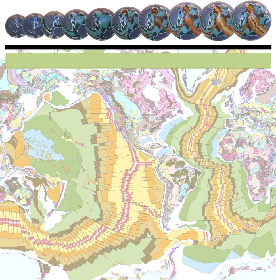
The continental crustal development of Africa and Arabia on an Expansion Tectonic Earth. In each of the Precambrian and Palaeozoic models North Africa is shown located south of the ancient equator and the South Pole is located in west Central Africa. The Archaean to Triassic models are centred on the South Pole (blue dots). The horizontal red line represents the location of the ancient equator and the black lines represent the African continental crustal outlines.
Throughout Precambrian and Palaeozoic supercontinent times the ancient South Pole was located within what is now Central West Africa and during that time a south-
Breakup of the ancient Pangaea supercontinent to form the modern African and Arabian continents was first initiated between West Africa and North America during the Permian and Triassic Periods during opening of the North Atlantic Ocean. Rifting and separation between South America and Africa, as well as between Africa, Antarctica, Madagascar, and India, commenced during the Jurassic adjacent to what is now South Africa. This rifting continued north, within the opening South Atlantic Ocean, to eventually join with the North Atlantic Ocean. Similarly, rifting continued north along the East coast of Africa during opening of the Indian Ocean which eventually gave rise to the modern African continental outline.
Rifting and separation of Africa from Arabia, and similarly Africa from the Mediterranean and Middle East regions, commenced during the Cretaceous Period during opening of the Mediterranean Sea and this rifting is continuing to the present-
During the Mesozoic and Cenozoic Eras, Africa and Arabia continued to slowly migrate north, relative to the South Pole, in conjunction with opening of the Atlantic and Indian Oceans. From its central West Africa location throughout Precambrian to Palaeozoic times, the ancient South Pole is shown to have made an apparent migration south—due to the northward movement of Africa away from the southern polar region toward to equatorial region—along the west coast of South Africa. It then crossed the newly opening South Atlantic Ocean during the Mesozoic Era and continued onto the Antarctic continent during the later Cenozoic Era. This apparent polar migration severely disrupted existing plant and animal species development within Africa as the polar climate zone also experienced an apparent migration south across the land surface.
Once the ancient South Pole crossed the Atlantic Ocean, much of Africa and Arabia maintained a centrally-
It is interesting to note that on an Expansion Tectonic Earth a direct geographical connection across to Europe and Asia is maintained throughout Earth history and only relatively recently are the continents shown to be separating and rifting along what is now the Mediterranean and Red Seas. This, of course, is at odds with plate tectonic assemblages where Africa and Arabia are said to be migrating north and colliding with Europe and Asia to form the Alpine Mountain belt.
This conventional migration and collision, however, cannot explain the opening of the Mediterranean Sea during the late-